
Trace a Hillsborough Street Directory
Begin with the address as Hillsborough records it, then keep the Hillsborough situs, block, lot, qualifier, and deed reference together. The county map supplies Hillsborough parcel context, while the Township Assessor can discuss current ownership or a mailing address on file. A deed records a transfer party, not necessarily a current resident. A historic directory can identify an occupant, not necessarily an owner. Those labels matter when following a Hillsborough road through a large township with rural parcels, village names, and nonresidential land.
- Enter the Hillsborough road number in the Somerset County Tax Parcel Viewer and confirm the correct parcel polygon.
- Write down the Hillsborough block, lot, qualifier, and any deed book or page reference shown in the tax material.
- Ask the Hillsborough Assessor about the current municipal ownership or mailing record when the public map lacks an owner field.
- Open the County Clerk land-record index by book and page, instrument number, name, or legal description to read the Hillsborough transfer trail.
- For a Hillsborough historical lead, search the regional directory and newspaper shelf by road, village label, and surname, then compare the evidence by date.
This order prevents a common error: treating an address label, a mailing line, and a recorded party as the same fact. They can support one another, but they are separate fields with separate dates.
Hillsborough Street Directory Parcel Records
The 2026 Hillsborough tax list is a practical crosswalk for an address search. It carries owner and additional-owner lines, property location, owner mailing address, block, lot, qualifier, account, deed book, deed page, class, and ZIP or billing information. The Hillsborough property location is the situs, the place the parcel occupies. The mailing address is where the Assessor sends correspondence. It may belong to an institution, a trust, or a person elsewhere, so it is a lead rather than proof of occupancy. For current assessment questions, contact the Hillsborough Township Assessor at 908-369-8077 during Monday through Friday hours of 8:00 a.m. to 4:30 p.m.
Hillsborough's annual reassessment also explains why a municipal record and an older deed can differ. The Hillsborough Assessor reviews values annually and can inspect a property at least once every five years. Assessment and tax-payment questions belong to different Hillsborough functions, so an address search should not send a deed question to the Tax Collector.
Note: A tax-roll mailing line can help locate a recorded owner, but it does not establish present residence at the parcel.
Hillsborough Street Map Fields After 2024
The Somerset County Tax Parcel Viewer is the Hillsborough map step. Its 2024 redesign documented address, block/lot, and property-class searching, along with 200-foot notification and search reports, bookmarks, basemap switching, and layer controls. Select a Hillsborough parcel after searching, then inspect its attributes before moving to an adjacent polygon. The viewer is strong for geometry and tax identifiers, but the public parcel layer redacts owner names.
| Viewer control | How it helps an address search | What to retain |
|---|---|---|
| Address | Finds a Hillsborough parcel by its situs or road number | Exact displayed address and selected polygon |
| Block/Lot | Resolves a Hillsborough road-number conflict or a parcel without a conventional address | Block, lot, and qualifier |
| Property Class Code | Separates Hillsborough residential, exempt, farmland, or other parcel types | Class context before drawing a people conclusion |
| 200-foot search | Produces a Hillsborough nearby-parcel report or map when available | Nearby parcel identifiers, not assumed household names |
| Bookmarks, basemap, layers | Preserves a Hillsborough street segment and changes map context | Road, parcel, zoning, and tax-map context |
The county parcel FeatureServer metadata shows the fields available behind the map.
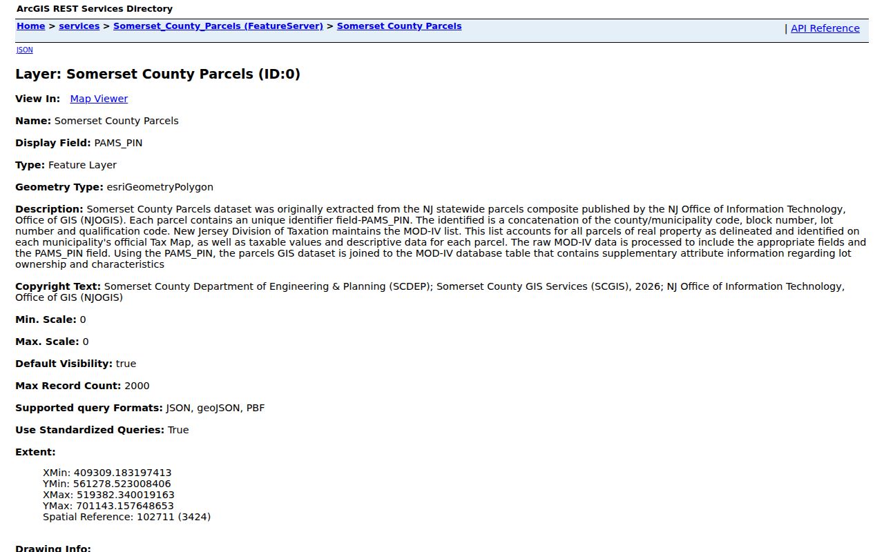
LandDesc, Acreage, Zoning, TaxMap, BuildDesc, DeedBook, and DeedPage are especially useful when a Hillsborough road label alone is uncertain. Copy the Hillsborough deed reference before leaving the map, because the next step is the land-record index rather than a second attempt to infer an owner from the redacted layer.
Hillsborough Street Deed Chain
The Somerset County Clerk land-records office connects a Hillsborough parcel to recorded deeds, mortgages, liens, maps, and related instruments. The online search offers Name, Book/Page, Instrument Number, and Legal Description categories. Documents recorded before January 1, 1977 are available through the Alpha Index. A free account is required to view images, and the public Records Room is another access channel. Staff can explain the computerized index, but they do not perform a title search.
Use the current Hillsborough deed book and page from tax material to open the instrument, then record the grantor, grantee, recording date, legal description, and prior-reference language. Search the seller as an earlier buyer and compare the legal description with Hillsborough block and lot. A subdivision, merger, easement, or changed road number can break a simple address trail, so the legal description is the Hillsborough continuity check. The Clerk's online search tutorial documents the available search modes.
Hillsborough Street Permit Trail
Permit records can date work at a parcel even when ownership did not change. Hillsborough directs account holders to SDL for permit status, plan review, inspections, property information, and OPRA functions. The township says users select Hillsborough as the primary town. The public material confirms the portal route, but it does not verify the exact inner search fields visible without an account or session.
The Building Department also accepts inspection scheduling through SDL, an emailed inspection form, or an in-person route, and permit applications may be mailed or dropped off. A requested record can contain address-linked applicant, owner, contractor, status, review, or inspection information subject to the available record and redactions. When an exact document is needed, the Hillsborough Construction Department and a narrow OPRA request are the documented fallback channels.
Note: SDL confirms a permit and property route, but an unauthenticated public screen does not establish every field in a Hillsborough result.
Hillsborough Street Voter List Limits
New Jersey's Am I Registered? service is a self-status tool, not a public browse for every person on a Hillsborough road. The separate county route is the Somerset Board of Elections request form for a Hillsborough municipality, district, or other lawful area. It offers CSV, PDF, or text delivery and supports specified party, registration-date, and limited voting-history choices. A Hillsborough district map can narrow an address question, but it does not identify every person at a parcel.
The county form states a typical one-to-two-week fulfillment period and a political-use restriction. Hillsborough protected addresses are omitted, signatures and identity numbers are not public list fields, and ballot choices are never disclosed. Treat a returned result as a Hillsborough registered-voter record with its own rules, not as a household directory. The Somerset voter-list request form is the authoritative source for scope and delivery choices.
Hillsborough Street Directory Place Names
Road research in Hillsborough benefits from using more than the township name. Belle Mead, Blackwells Mills, Flagtown, Neshanic or Neshanic Station, and South Branch are place-name variants that can appear in a postal line, local history source, newspaper, or older directory. A record under Neshanic Station may still point to a Hillsborough parcel, while the same transfer may be indexed by legal description at the County Clerk. Search the village label beside the road name, then bring the result back to the block, lot, and map.
For older occupants, SCLSNJ holds Somerville City Directories from 1917 through 1984 as a regional proxy, not a dedicated Hillsborough run. The library also holds relevant newspaper microfilm. A reverse or criss-cross entry begins with a street and number, then leads back to the alphabetical entry. The historical shelf is explained in more detail in the Hillsborough city directories collection, where its limits and library sources are kept together.
Hillsborough Street Directory Definitions
Address records use terms that should be separated before comparing sources. A record can be useful without describing a present household.
- Parcel
- A taxed piece of land shown as a polygon in the county GIS, identified in Hillsborough by block, lot, and sometimes a qualifier.
- Situs address
- The physical Hillsborough property location used by the Assessor and tax list. It can differ from the owner's mailing address.
- Plat
- A recorded map that can show a Hillsborough subdivision, lot arrangement, or change in land configuration. Follow it when an old deed description changes.
- Criss-cross directory
- A reverse directory arranged by street and number rather than surname. Its entry is a Hillsborough occupancy clue for that publication year.
Note: When the road number and the legal description conflict, retain both and resolve the difference with the parcel map and recorded instrument.
Hillsborough Street Tax Classes
Not every polygon along a Hillsborough road is a private residence. Hillsborough tax material includes farmland, cemetery, public, school, park, institutional, and other parcel types alongside class 2 residential property. LandDesc and BuildDesc help explain why a visible Hillsborough parcel has no ordinary dwelling pattern. This is particularly important near Hillsborough agricultural land, open-space holdings, and historic landscape. A 200-foot result is a nearby-parcel tool, not a census of people.
The public Hillsborough GIS context is free and convenient, but its 2024 owner-name redaction means a map result should lead to Hillsborough assessment contact or a recorded deed when an ownership question is valid. That split is useful rather than a flaw: the map supplies the location and identifiers, while the official custodian supplies the corresponding record.
Hillsborough Street Directory Address Records
Each address-keyed source has a narrow role. Pairing them is more reliable than searching a single list for a blanket answer about a road.
| Address source | Best search key | What the record can establish | Access path |
|---|---|---|---|
| Hillsborough assessment and annual tax list | Hillsborough situs, block, lot | Municipal owner and mailing line, property location, class, deed reference | Hillsborough Assessor contact and official tax material |
| Somerset County Tax Parcel Viewer | Hillsborough address, block/lot, class | Hillsborough parcel geometry, attributes, zoning, tax and deed metadata | Free ArcGIS viewer |
| County Clerk land index | Book/page, instrument, name, legal description | Recorded Hillsborough grantor, grantee, instrument, and legal land description | Online index, free-account images, Records Room |
| Hillsborough SDL permit/property route | Hillsborough address or property | Permit, plan-review, inspection, and related released fields | Account, department channels, or OPRA |
| Hillsborough voter-list request | Municipality, district, other area | Lawfully released registered-voter fields within the requested scope | Board of Elections request process |
| Hillsborough regional directories and newspapers | Road, surname, village, date | Historical occupant and event clues | SCLSNJ library collections |
Use the wording that fits the record: recorded owner, tax-roll mailing address, registered-voter result, or historical directory occupant. That precision is the difference between a sourced street search and an unsupported claim.
Hillsborough Street Results: Clear Limits
Hillsborough public property records do not list every member of a household. A Hillsborough mailing address may belong to a trust, business, or another residence. Directory entries can name a non-owner, and the voter route covers registered voters only under its statutory access rules. Motor-vehicle address data is restricted, and utility or delivery customer files are not ordinary public resident records. New Jersey's Address Confidentiality Program and Daniel's Law can lawfully substitute or redact a Hillsborough address, so an absent result may reflect protection rather than an error.
Lawful use. New Jersey stalking law, N.J.S.A. 2C:12-10, sets a factual limit on repeated monitoring, threats, intimidation, or harassment. Use address records for a lawful personal purpose and do not pursue a protected or private address.